This thread has been locked.
If you have a related question, please click the "Ask a related question" button in the top right corner. The newly created question will be automatically linked to this question.
Part Number: IWR6843AOP
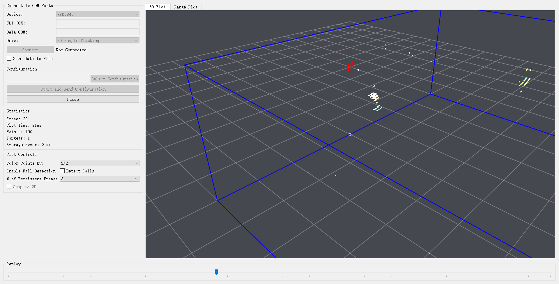
我在自己对采集到的数据进行可视化时,弄不清雷达所在坐标是哪个?并且到底是哪个是x,y,z轴,导致我看不懂点云的变化,请帮助我确定我的雷达的坐标系是怎么建立的,原点位置代表什么,雷达的坐标是什么?
您好,已经收到了您的案例,调查需要些时间,感谢您的耐心等待。
原点位置为地面,红色图标表示传感器相对于地面的位置。若您与雷达朝向相同,沿瞄准轴线移动代表y轴方向,从传感器向左右移动代表x轴方向,上下移动则代表z轴方向。